
Data Processing
The data collected as part of both the ILUA I and II field inventory campaign provides a wealth of information to the Forestry Department as well as other government stakeholders and projects operating in the forestry sector.
This data is comprised of both biophysical and socio-economic data as well as several spatial data sets including land use change and forest biomass. Much of the information contained within these data sets will, in the future be required by the forestry sector for appropriate planning and project implementation. The ILUA II programme undertook a technical study outlining how data sharing processes will operate during and after the completion of the project. The data sharing guidelines recognise the importance of the data and highlight this importance accordingly.
It is therefore very important that all the available data and information is arranged in a form that can help the Forestry Sector respond to new developments and concerns, such as forest governance, deforestation, climate change, and over-dependency on wood biomass as an energy source.
The guidelines further disaggregate data collected as part of both ILUA I and ILUA II into three stages of data and information access. These are copied below:
- Primary data – this refers to forestry field or RAW data collected from inventories, experiments, and other field studies useful for archiving in public primary data repositories. It is considered very sensitive, especially demographic surveys, and may need securing. This data will not be shared without authorization from the Director of Forestry.
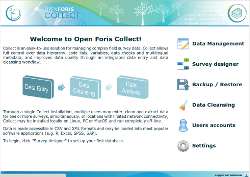
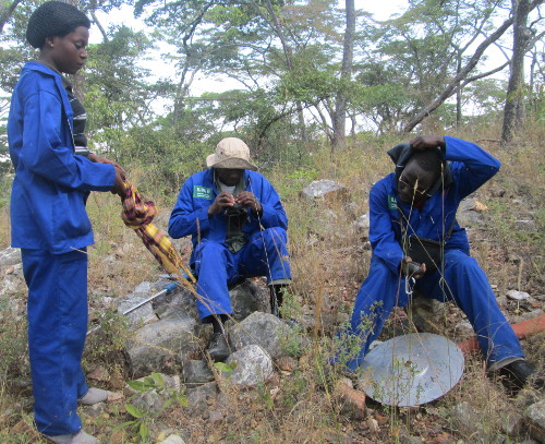
 Data entry stage
 - Data subjected to preliminary analysis – this refers to forestry data that has been subjected to an initial analysis (e.g. the determination of the basal area for different timber species harvested in forest concessions). This kind of data may be termed ANONYMIZED if it includes information on personal concession owners, financial status, timber market related data or other data that has to be created without identifiers and is moderately sensitive. The data in this category has been organized into an appropriate form for analysis, often in several different ways , depending on the required analysis. This information will not be shared via this website but the Forestry Department is working on a concession management tool which will allow for the online management of concession licenses.
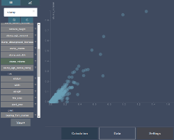
- Data subjected to final analysis – this type of data usually comes from an analysis of any data, including forestry data to provide tree or stand volumes; wood biomass; and classification into soil, vegetation, forest cover, and land use types. This kind of data is termed AGGREGATED and is prepared by grouping, processing and categorizing data statistically, numerically or descriptively. It is usually descriptive of its constituent population and is usually ready for publication and considered least sensitive. This is the format of the data which is going to be shared via this website. In all cases aggregation of the information has been undertaken using advanced statistical methods utilizing the Open Foris Collect and Open Foris Calc tools.